Anne Anderson Work examples, 2007-2017

2015-2017: PG&E, San Ramon and Concord, CA

Planning map for methane-sensing car routes.
Leak survey data overlaid onto Google Maps as common communication tool.

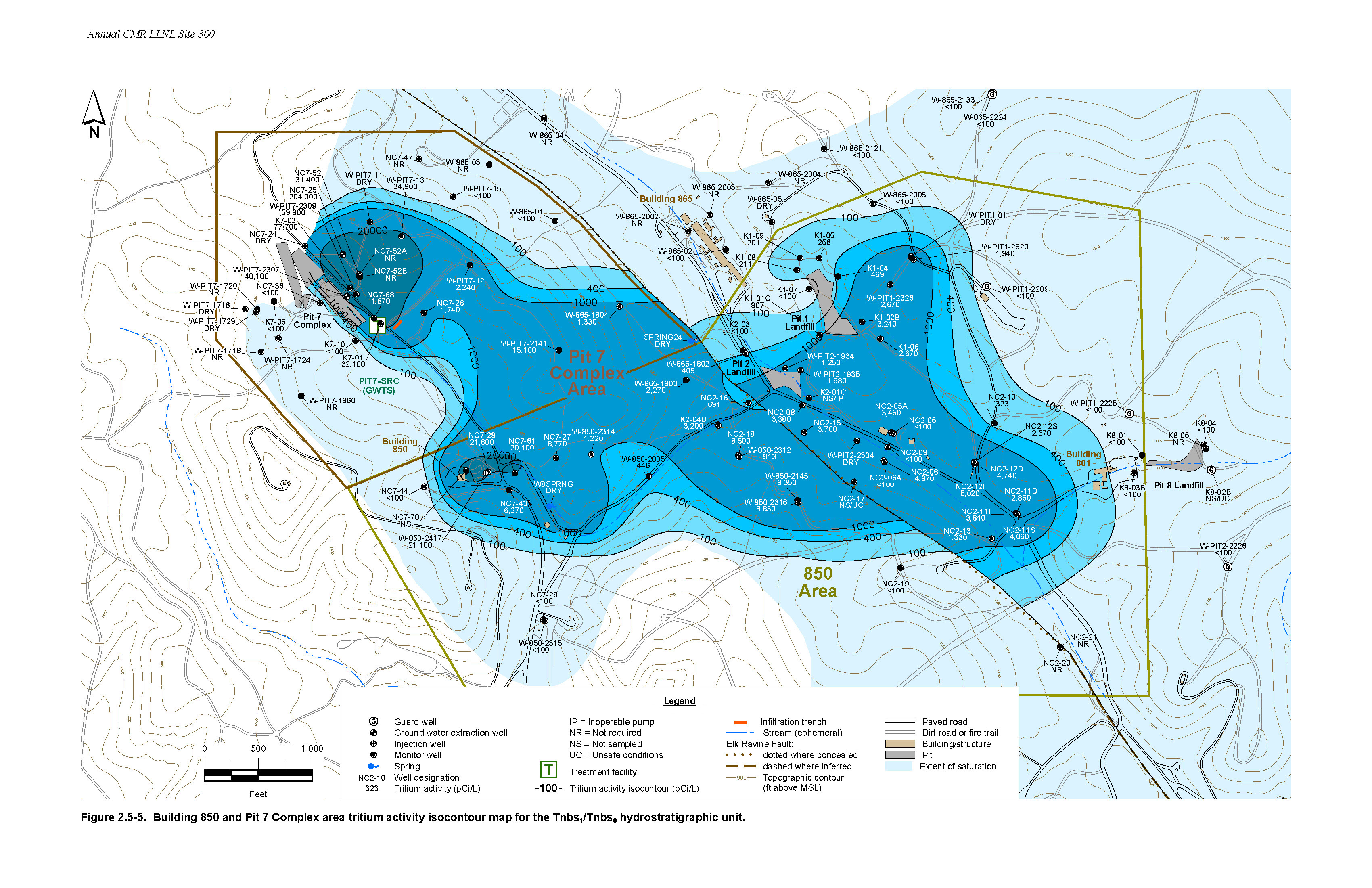
2008-2014: Environmental Restoration Department, Lawrence Livermore National Laboratory, Livermore, CA. I produced GIS figures for Federal soil and groundwater contaminant monitoring reports.

Site 200 Well Map
Comprehensive full-size wall map of LLNL Site 200. Shows treatment facilities and all wells. Well types and hydrostratigraphic units are also indicated.
LLNL Site 300. Map shows GPS locations of depleted uranium on soil surface.

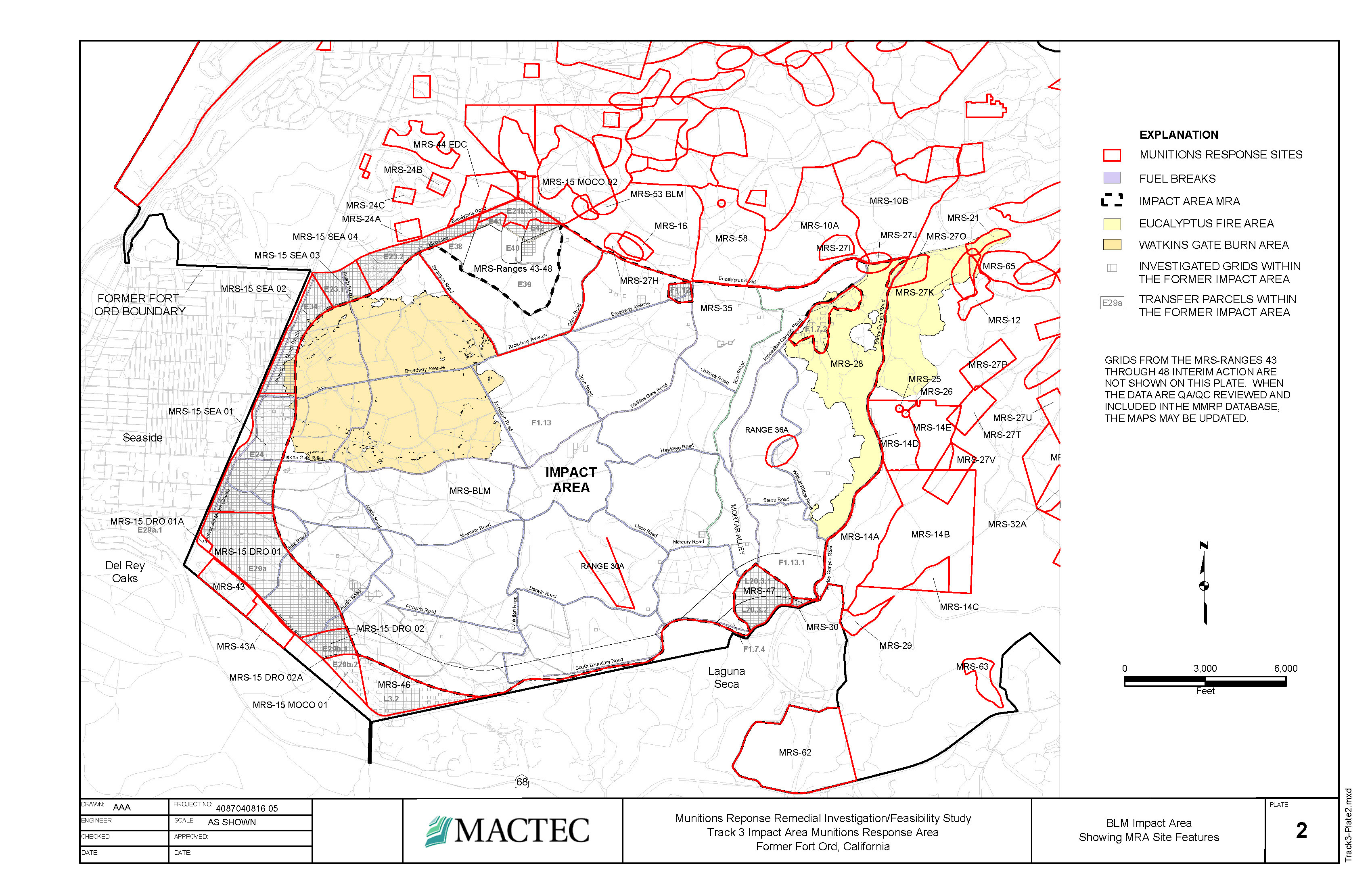
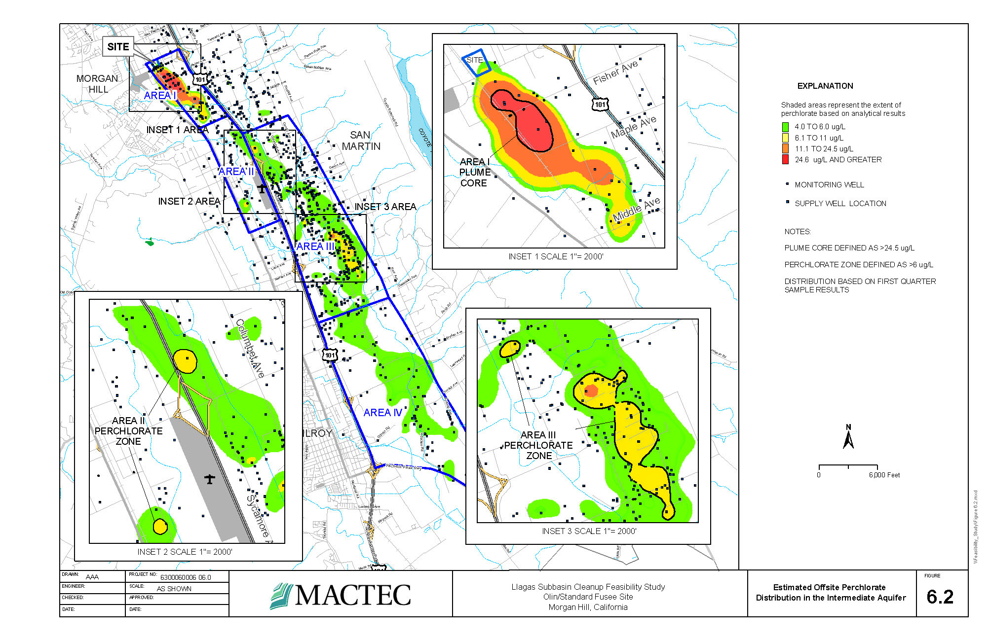
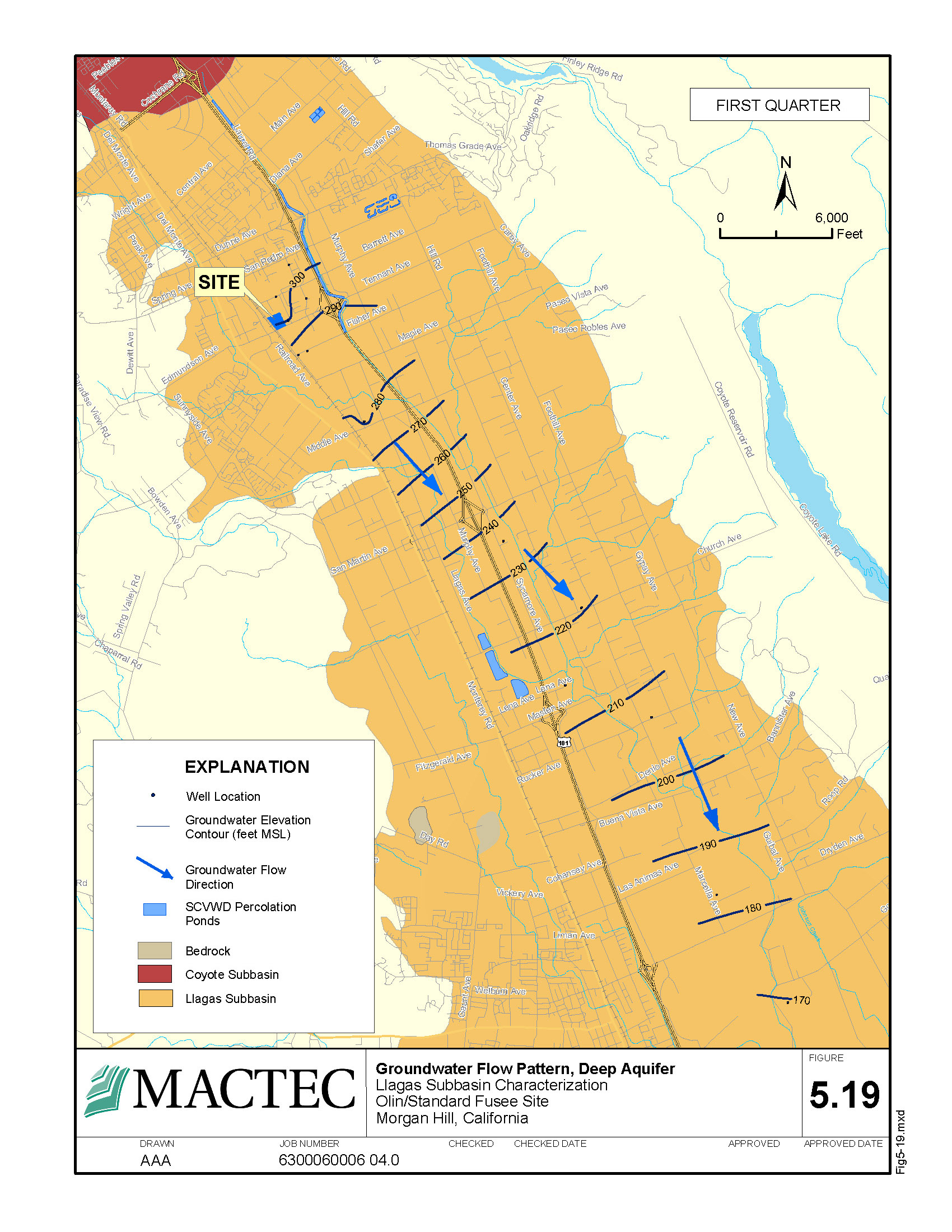
2005-2008: MacTec Engineering, Inc., Oakland, CA. I produced detailed maps and AutoCAD cross-sections for hydrogeologists and other analysts who worked on contaminant mitigation studies.

MacTec conducted an investigation and feasibility study at the former Fort Ord military base. One of my roles was to reconfigure and convert the existing GIS database to comply with Federal standards.
AutoCAD geologic cross-section for Olin/Standard Fusee site.
Morgan Hill, CA. Perchlorate was left in groundwater and soil by Olin Corporation who produced road flares in the 1960s and 1970s under the name Standard Fusee Corp.
Perchlorate distribution in the intermediate aquifer at Olin/Standard Fusee site. Plumes created by hydrogeologists and imported to GIS.
Groundwater flow analysis figure at Olin/Standard Fusee site.
Olin/Standard Fusee site. The imported aquifer image was created by a hydrogeologist who used third-party analysis software.